Strategic Land at Crofton Wakefield
Price: Planning Promotion Terms sought
Address: Land at East of Crofton, Wakefield
Key Features:
- Strategic Land Opportunity
- Promotion Agreement or Option
- Proposals sought by Noon Friday 20th June 2025
Executive Summary
- The land forms part of The Nostell Estate, a privately owned business which has been Lord St Oswald’s family for over 350 years. It currently comprises an award-winning office park at Nostell, over 2,000 plus acres of farmland and a portfolio of some 40 residential dwellings.
- Further details are available from the Estate’s website: www.nostellestate.com
- The subject landholding is all situated on the Eastern edge of the village of Crofton.
- It is considered the land offers excellent medium-term potential for the delivery of new homes and possibly other ancillary development, subject to receipt of all necessary planning consents.
- Occupying a prominent and very accessible position within proximity to Wakefield and the wider West Yorkshire conurbation.
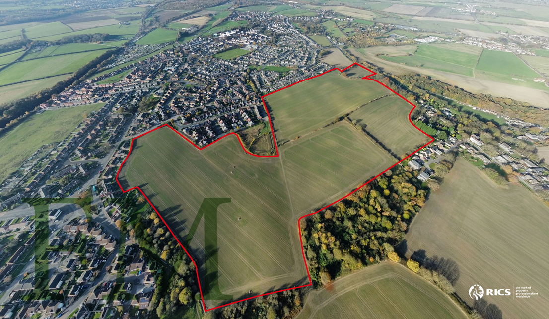
- Total area extending to approximately 70.5 acres (28.5 ha).
- Sustainable, viable and deliverable sites.
Planning Promotor Sought, or consideration may be given to entering into an Option Agreement sale structure.
Location
Crofton is a located in West Yorkshire and situated approx. 5 miles southeast of Wakefield and 4.5 miles south of Normanton and 7 miles west of Pontefract.
Whilst Crofton can be traced back to the Doomsday Book in 1086, its more recent history was one of a farming community, followed by coal mining in the 19th century, up until the last mine closure in the mid 1980s. There were 3 coal mines within 2 miles of the village; at Nostell, Walton and Sharlston. With a need to house the workforce required for these mines, there was significant growth in house building over that period and resulting expansion of the village with the establishment of New Crofton in the early 1900s
Today Crofton serves more as a commuting village to nearby Wakefield, Pontefract and Leeds. The village supports a number of local facilities including; medical practice, dentist, post office, hairdresser, Convenience food store, several pubs and both the Junior School and the highly acclaimed Crofton Academy Senior School.
The village is well served by bus routes providing regular services to Wakefield, Knottingley and Pontefract.
The A638 Doncaster Road which borders the north side of the subject landholding links with the A655 giving easy access to the M62 at Junction 31.
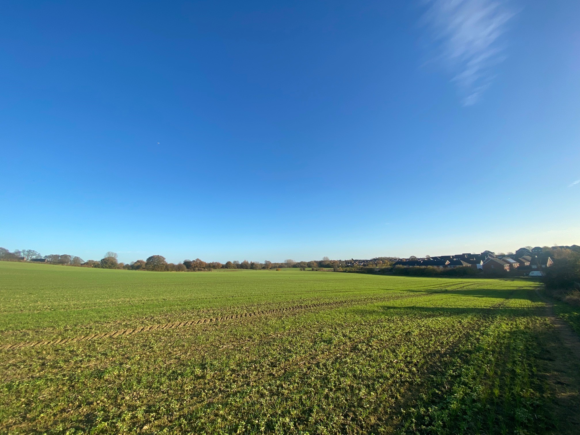
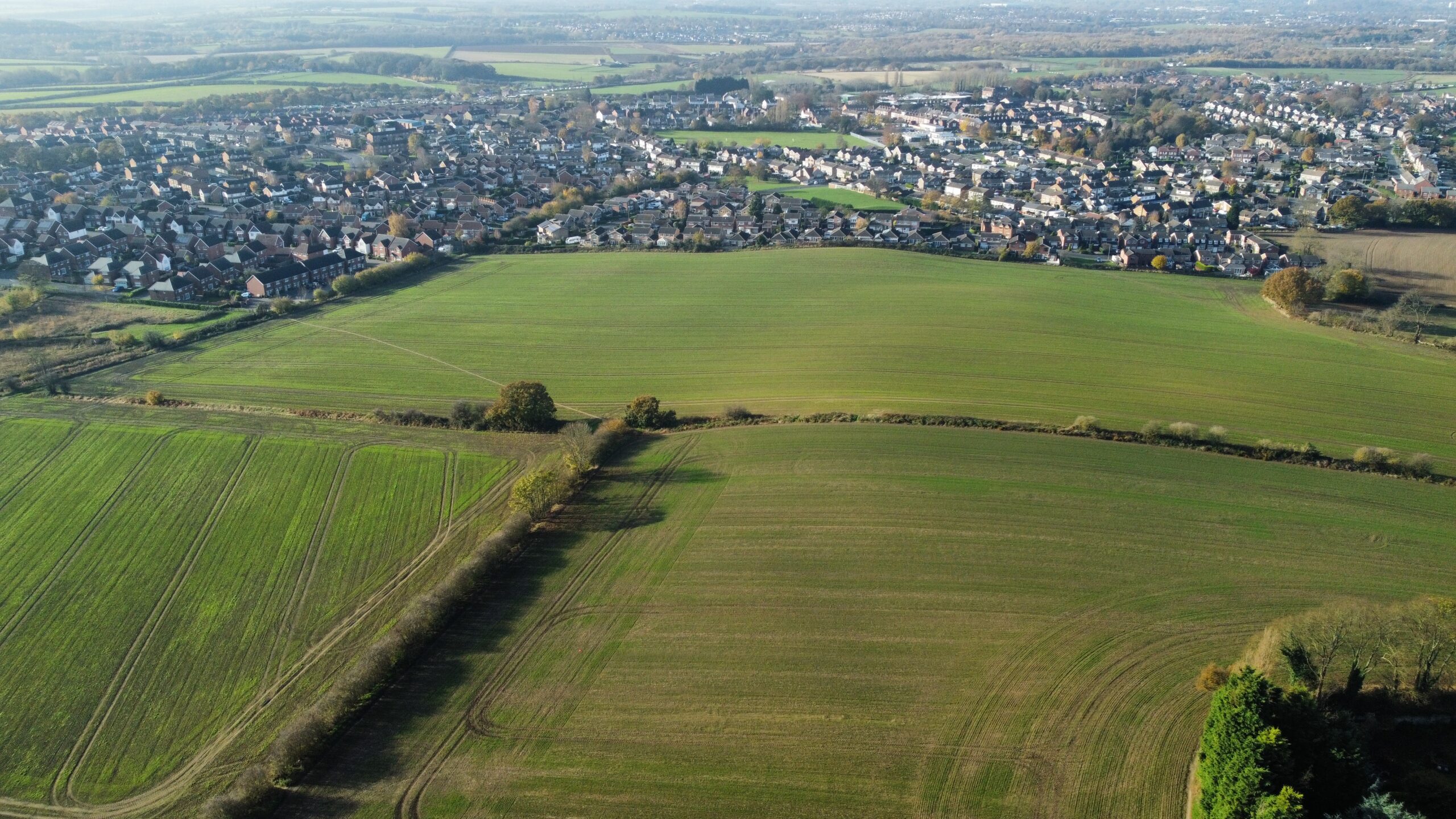
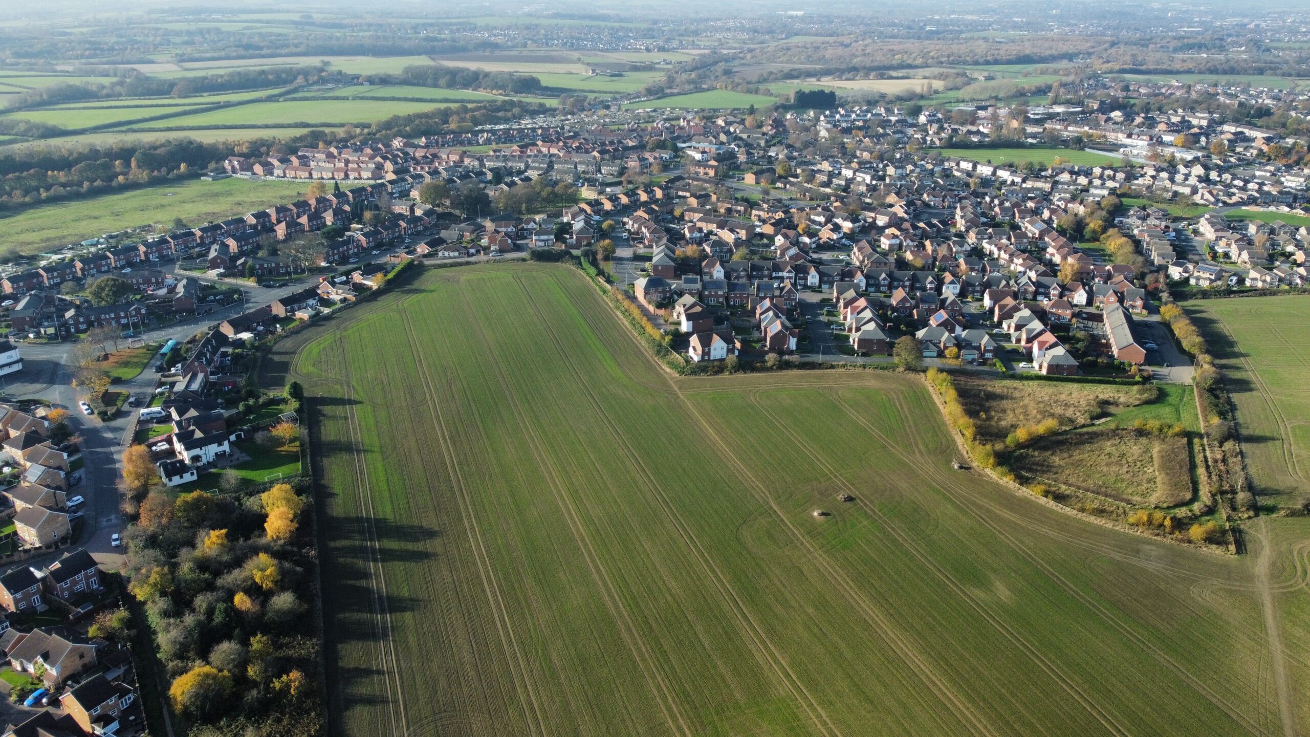
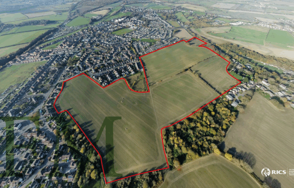
The Property
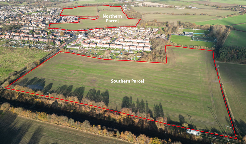
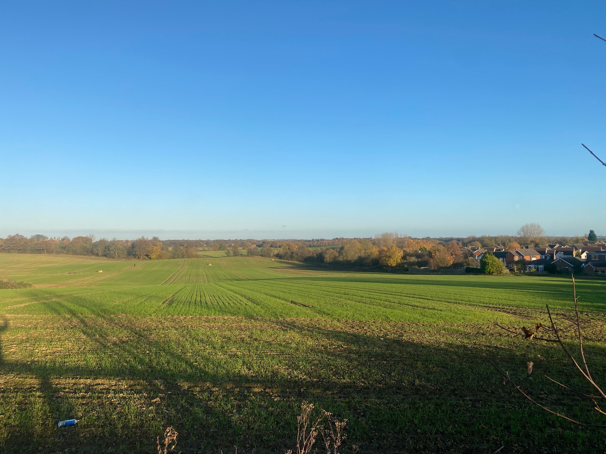
The property currently comprises two blocks of what can best be described as agricultural land, situated on the ‘urban fringe.
The northern most parcel of land is bordered almost entirely along its Western and southern sides by established housing, the most recent part having been developed by Redrow Homes approx. 5 years ago and known as Nostell Fields situated off Priory Ridge. This ‘protrudes into the subject land, and also incorporates a large balancing pond lying due east of the new dwellings.
The land is well screened with established mature woodland tree belts enclosing it to the north and east.
Access is currently achieved via the public highway at Priory Ridge, off Santingley Lane. It is considered possible that any future development of the land may also include access from the A638 Doncaster Road, which borders the northern most point of the Property.
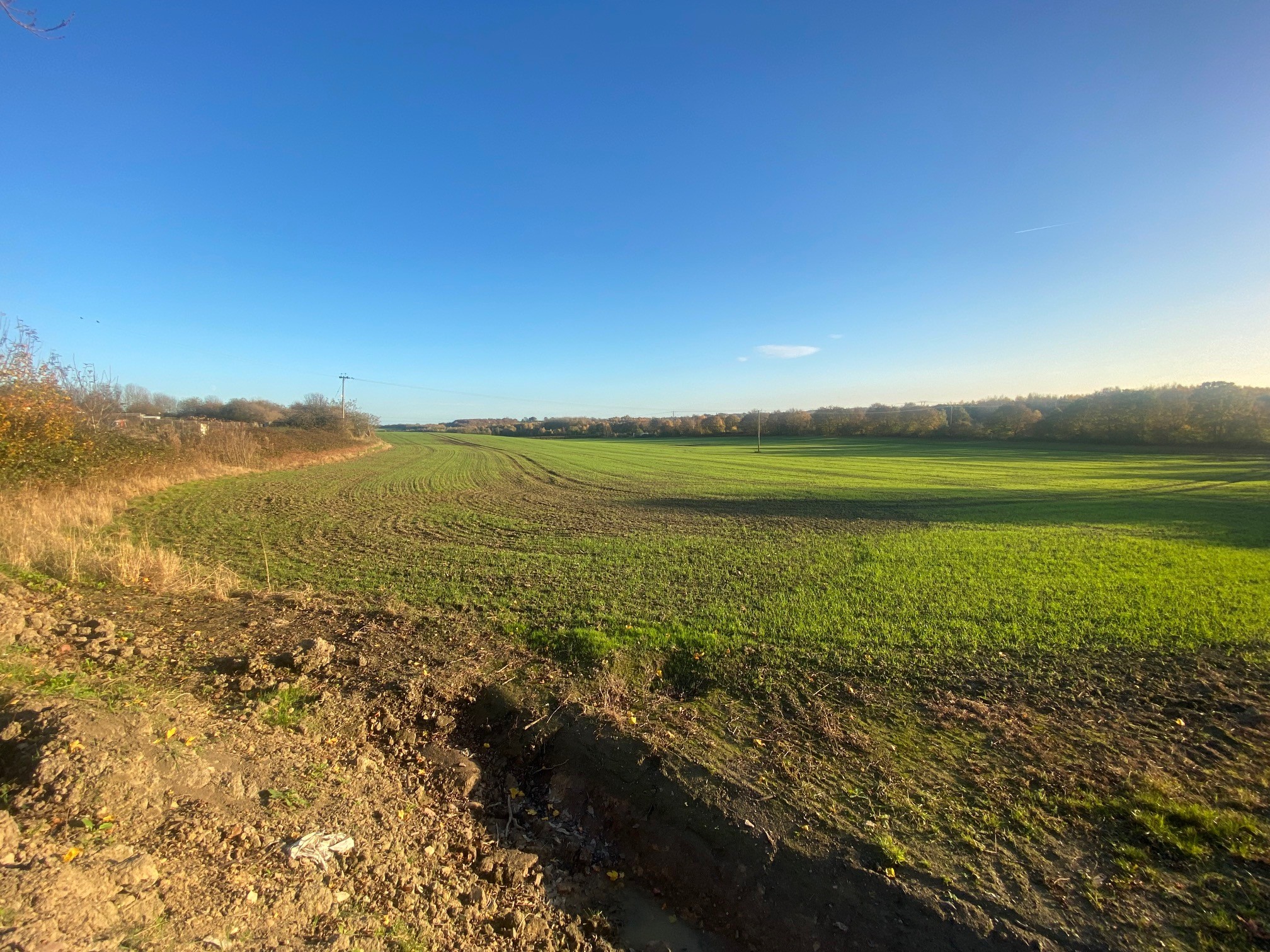
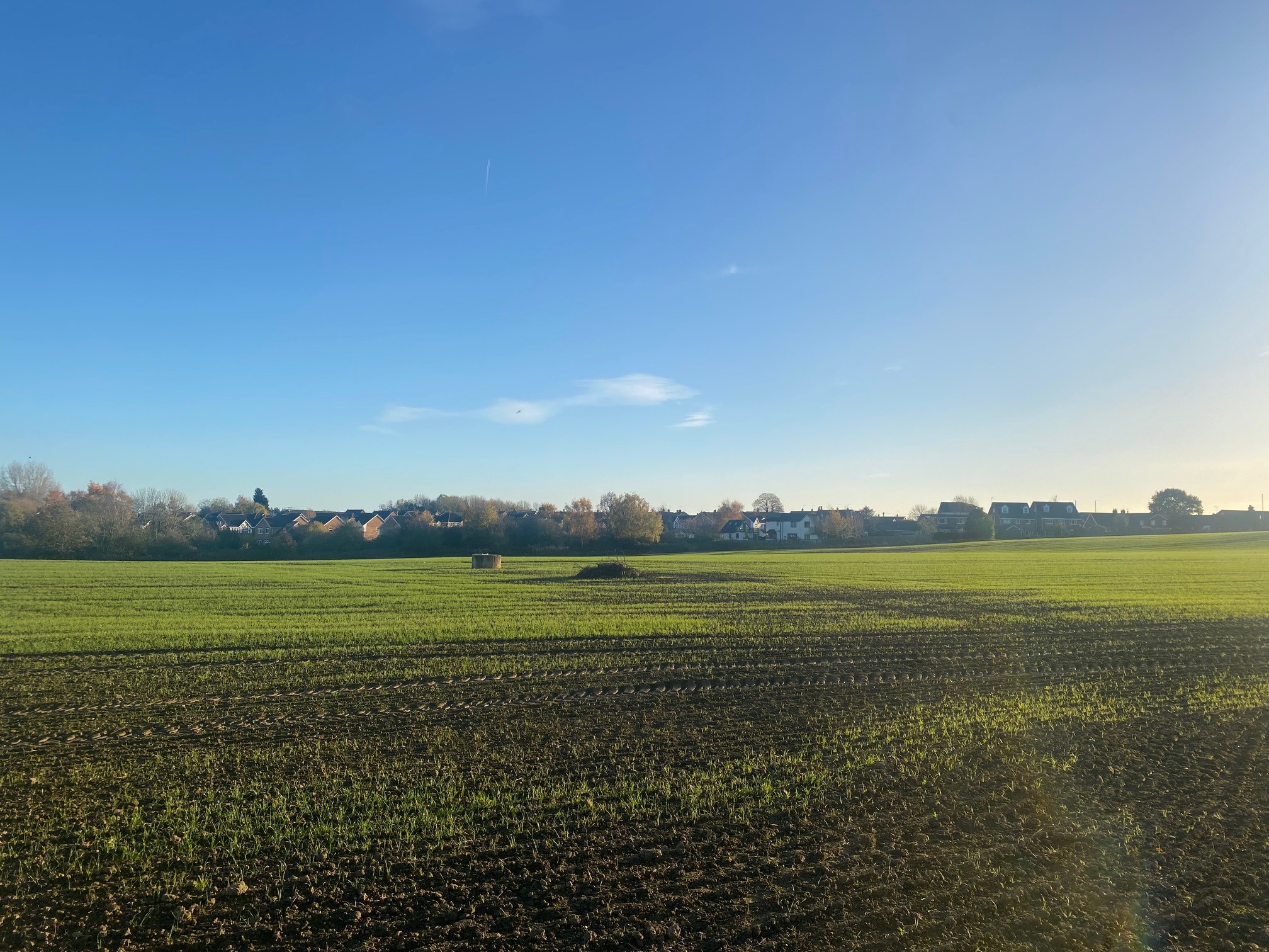
The land is gently undulating, and of open aspect. It is classified Grade 2 (Good to moderate) and currently used for arable cropping in rotation.
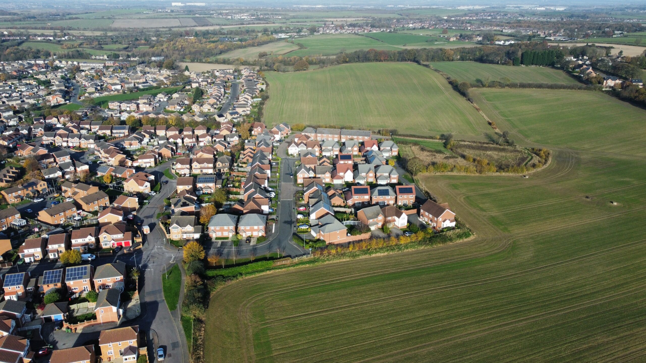
The southern parcel of land is located on the southeastern edge of the village, adjoining what is known as ‘New Crofton’. It slopes gently from north to south, with frontage on the West to Santingley Lane. The southern border is the railway line.
Access for existing use is taken from adjacent land to the southeast, but it is envisaged that for any future development, access could be achieved either via Middle Lane or Santingley Lane.
The land is currently used for arable cropping in a rotation and classified as Grade 3 (Good to moderate).
All of the land sits outside any designated Flood Zones.
Site Area
The total land which is currently being offered for future development extends to approximately 70.5 acres (28.5 hectares) as shown outlined in red on plan enclosed herein.
The land is split between the Northern and Southern parcels, with the flowing areas:
| Description | Acres | Ha |
| Northern Parcel | 52 | 21 |
| Southern Parcel | 18.5 | 7.5 |
| TOTAL | 70.5 | 28.5 |
The Estate owns additional land to the East, and where there is justification to include further landholdings, (possibly for enabling development works/infrastructure etc), this could also be made available for inclusion if required.
Planning
All of the land falls within Wakefield District Council’s jurisdiction. Planning Policy is set via its Development Plan Document, which was adopted on 24th January 2024. The new Local Plan for the District sets out the policies by which planning applications for new development will be considered. It also identifies developable land suitable for housing, employment, mixed use and recreation up to 2036, although the Council will have an obligation to monitor and renew those allocations at various intervals. The first review will be in 2029.
Wakefield Council in adopting their Local Plan, excluded the subject land on the basis they felt confident they had allocated sufficient housing and employment land to meet their statutory obligations at that time. It is acknowledged that the fact the land all remains allocated within a Green Belt policy, (as well as the corridor safeguarded for HS2) may not be particularly positive for release of development opportunities in the short term. That said, National Planning Policy is changing, and with it, a requirement for all Local Authorities to review their Local Plans sooner, as well as taking into account the variations included within the newly adopted National Planning Policy Framework. (NPPF 24).
The NPPF 24 adopted by the Ministry of Housing, Communities & Local Government, on 13th December 2024 sets out some significant national planning policy reforms. One of the key variations is around the new Standard Method of assessing housing need. Generally, across the Country as whole, the new Government is looking to establish a much more robust and rapid delivery of new houses, with substantial increase in numbers. For Wakefield District the projected increase is between 75%-100%. The following are some headline statistics taken from an article published by Planning Consultants Lichfield’s: (Lichfield’s Blog by Matthew Gregg – ‘What the proposed Standard Method will mean for Yorkshire and The Humber’. 9th August 2024)
| Calculation Method | Dwelling Numbers pa | % Difference from Proposed Standard Method |
| Proposed new Standard Method | 1,721 | |
| Current Standard Method | 923 | +86% |
| Current WMDC Local Plan | 1,400 | +23% |
| Net Additional Dwellings 3-year Average for WMDC | 1,376 | +25% |
It is clear that the latest Standard Method of establishing housing need, moves Wakefield District Council into a position whereby they are going to be forced to undertake a much earlier review of their adopted Local Plan, and take steps to add additional sites to their allocation list.
One of the other key variations set out within the new NPPF, as drafted, is the re-introduction of the obligation for Local Authorities to prove they have a defensible 5-year housing land supply, plus a 20% buffer thereon. The recent article referred to above by Lichfield’s, suggests that many Local Authorities are already falling behind this threshold requirement, and their figures state that Wakefield has a 5.88-year supply, thus failing the 20% buffer provision, and as a consequence it is unlikely to be in a position to be able to defend the 5 year land supply under the new Standard Definition.
Coupled with these other changes to the NPPF, the Government is looking to introduce a policy of ‘presumption in favour of sustainable development’ where Councils fail to meet their housing targets, and that will include release of Green Belt land. For Green Belt land to be considered, there must be a justification that it meets the designation of ‘Grey Belt’ in so far as will need to offer limited material benefits to the Green Belt, and likely to be previously developed land, brownfield land or similar.
The whole process associated with the introduction of the new NPPF 24, and the very clear political will to materially increase housebuilding, will necessitate Local Authorities to not only review their housing allocations, but also those with large Green Belts, the expectation will be for those areas to be reviewed and in some cases, boundaries changed so that hitherto Green Belt land may well need to be removed from that designation.
With regard the land safeguarded for HS2, it is expected that this Local Plan designation will be reviewed following the announcements in October 2023 that the West Midlands to Leeds (Phase 2b – Eastern Leg) of HS2 was to be cancelled. HS2 Ltd have published confirmation that they are working with the Department for Transport (DfT) to carry out the Government’s new requirements for HS2, and whilst Safeguarding remains in place, this is to be amended during the summer of 2024, taking account of any land requirements for Northern Powerhouse Rail. This is not expected to affect the subject land, and so it is fully expected that the HS2 safeguarded route shown within the WMDC Local Plan affecting the land east of Crofton, will be lifted.
What is clear is that planning prospects change, and opportunities will present themselves.
For further information and detail associated with the Planning status for this site, interested parties are recommended to make their own enquiries directly with Wakefield District Council Planning Department. www.wakefield.gov.uk prior to submission of any proposals.
Services/Utilities
The land will be offered with the benefit of rights to connect into mains services, where available to do so.
Interested parties will be required to verify and undertake their own assessments of all utility services as part of their associated due diligence.
Site Surveys
There are currently no specific detailed site surveys available. Arrangements will be agreed as part of the structure of any planning promotion agreement, which will enable access to the land in order to conduct all necessary survey work required to support a planning promotion.
Tenure/Title Matters
The Northern Parcel of land is currently subject to a short form Farm Business Tenancy which is due to expire in October 2025. Thereafter the land will be taken back in hand by The Nostell Estate. All of the Land can be made available for sale freehold with vacant possession from October 2025 onwards. It is registered with Title Absolute under title numbers YY147350 and WYK237680.
Rights of Way/Wayleaves/Easements
The Property will be offered subject to and with the benefit of all rights of way, whether public or private, rights of light, support, drainage, and other rights, obligations and easements and restrictive covenants and all existing wayleaves, pylons, stays, cables, drains, water, gas and other pipes whether referred to in these particulars or not.
As can be seen from the OS Plan, the northern parcel of land does have a number of public footpaths crossing it along with various other utility easements. Further details can be made available from the agents on request.
VAT
The Vendor reserves the right to charge VAT in relation to any future sale of the Property.
Proposal
Our client is seeking to involve either a Promoter or Developer/Housebuilder to undertake the planning promotion of this site on their behalf with a view to the ultimate submission of a planning application, and onward sale/s.
The landowner seeks an optimisation of their asset value in the land, whilst also having regard to the quality of development and its lasting legacy on the Nostell Estate and Wakefield area.
It is envisaged that the chosen ‘Developer/Promotion Partner’ will have a proven track record and resources available to undertake all necessary promotion of this substantial opportunity. This will involve the preparation of architectural concept masterplans, and in due course more details layout plans and house type designs; all necessary on and off site surveys; lobbying; and submission of representations and in due course planning application(s).
They will be required to orchestrate and fund all associated costs through to the point of receiving a planning decision, and sale. They will also be responsible for all legal and surveyors costs in drawing up the initial agreement.
If this opportunity is of interest, you are invited to put forward terms upon which you would be willing to take this project forward, to include the following:
- The structure and commercial terms of your Offer.
- Confirmation of any specific obligations/ conditions envisaged under the terms of the Agreement.
- Confirmation of your funding arrangements.
- Confirmation as to Solicitors and any other Professionals that you intend to appoint to act on your behalf.
We are seeking offers to be submitted via email to Christopherfordy@fordymarshall.com by noon Friday 20th June 2025.
Each offer should address all of the points set out above. We will then look to review and may wish to discuss individual proposals submitted in further detail and/or invite you for further discussion/presentation.
Our clients do not undertake to accept the highest bid or indeed any proposal.
Viewing/Site Inspection
Viewings can be made from the adjoining public highways. Those wishing to walk the site should contact the marketing agents providing at least 48 hours’ notice. Inspections are undertaken at your own risk.
All descriptions, dimensions, areas, reference to condition and other details are given in good faith and believed to be correct but intending purchasers / lessors should satisfy themselves as to the correctness.
Plans
Location Map
Property Brochure
Arrange Viewing
Christopher Fordy07809 202300
christopherfordy@fordymarshall.com
Photo Gallery